As we all know, cities are developing at breakneck speed, with skyscrapers sprouting everywhere. Yet when heavy rain strikes, certain areas still succumb to flooding—evoking the ancient saying “water submerging the golden mountain.” This phenomenon, urban waterlogging, wreaks havoc on daily life, paralyzing transportation, damaging property, and threatening public safety. The imperative for advance warning systems becomes clear: we must know when floods threaten before they arrive, allowing time to prepare, evacuate, and protect. Thus emerges the critical demand for comprehensive flood prevention and early-warning monitoring systems.
Understanding Flood Prevention Early-Warning Monitoring
Imagine a city as a vast, complex family dwelling—thousands of rooms, countless inhabitants, intricate plumbing and electrical systems. Just as a vigilant household member watches for fire, gas leaks, or structural damage, flood prevention early-warning monitoring serves as the city’s ever-watchful “safety sentinel.” This sentinel maintains ceaseless surveillance over multiple environmental variables: meteorological conditions predicting rainfall intensity and duration; hydrological states of rivers, lakes, and reservoirs; and hydraulic conditions within the urban drainage infrastructure itself—sewers, storm drains, pumping stations, and retention ponds.
The sentinel’s role transcends mere observation. It must interpret patterns, recognize anomalies, and trigger appropriate responses across multiple timescales. Short-term alerts—minutes to hours—enable immediate protective actions: barricading flood-prone underpasses, redirecting traffic, deploying mobile pumps. Medium-term warnings—hours to days—allow strategic preparations: pre-positioning emergency resources, notifying hospitals and care facilities, coordinating interagency response teams. Long-term trend analysis—seasonal to decadal—informs infrastructure investment, zoning regulations, and climate adaptation strategies.
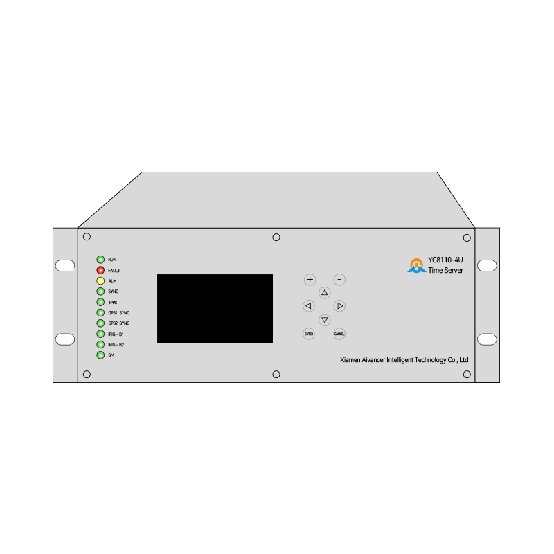
The Hydraulic RTU Telemetry Terminal

How does this metropolitan sentinel gather such comprehensive intelligence? The answer lies in distributed networks of specialized field devices—the hydraulic RTU (Remote Terminal Unit) telemetry terminals. These ruggedized instruments serve as the sentinel’s “trusted scouts,” deployed strategically throughout the urban watershed and drainage system.
Consider their typical deployment pattern. Along major rivers and tributaries, terminals occupy gauging stations at regular intervals—upstream, midstream, and downstream of the urban core—to capture flood wave propagation. At lakes and reservoirs, they monitor both water surface elevation and outflow rates, critical for managing storage capacity during storm events. Within the urban fabric, they inhabit sewer system nodes: major trunk lines, interception chambers, pump station wet wells, and outfall structures. In topographic depressions—natural bowls where water accumulates—they stand as early warning outposts, detecting ponding before it spreads.
Each terminal represents a sophisticated integration of sensing, processing, communication, and power management technologies. Their physical design reflects harsh field conditions: cast aluminum or stainless steel enclosures rated IP68, capable of indefinite submersion; wide-range temperature tolerance from -35°C to +75°C; vibration and shock resistance for locations near heavy machinery or traffic; and electromagnetic compatibility to operate reliably amid urban electrical noise.
The Sensory Apparatus
The terminal’s perceptual capabilities rival biological senses in sophistication. Water level measurement employs multiple technologies suited to different environments. In open channels and stilling wells, pressure transducers infer depth from hydrostatic pressure, with accuracy to ±0.1% of full scale and resolution of 1 millimeter. Ultrasonic sensors measure time-of-flight to water surface, ideal for locations where sensor contact with water is undesirable. Radar level sensors penetrate foam, steam, and condensation, maintaining accuracy in turbulent conditions. For critical applications, bubbler systems provide redundant, self-calibrating measurement.
Rainfall quantification utilizes tipping-bucket gauges with 0.1 or 0.2 millimeter resolution, heated versions preventing freezing in cold climates. Disdrometers may supplement these, classifying precipitation type and intensity through acoustic or optical analysis—distinguishing rain from sleet, hail, or mixed phases with significant hydrological consequences.
Flow velocity measurement deploys Doppler radar for non-contact surface velocity estimation, or electromagnetic and acoustic Doppler profilers for depth-integrated measurements. In constrained conduits, time-of-flight ultrasonic or cross-correlation methods provide full-pipe flow data essential for sewer system modeling.
Water quality sensors—turbidity, conductivity, pH, dissolved oxygen—add diagnostic capability, distinguishing stormwater from sewage, detecting illicit discharges, and tracking pollutant loads.
These sensors connect to the terminal’s data acquisition system through ruggedized cabling or wireless sensor networks. The terminal’s internal processor—typically an ARM-based microcontroller or industrial-grade CPU—manages sampling schedules, applies calibration coefficients, performs quality control checks, and buffers data for transmission. Local data storage—SD cards or solid-state memory—ensures continuity during communication outages, with capacity for weeks or months of high-resolution data.
Communication
The terminal’s communication capabilities determine the timeliness and reliability of early warning. Modern hydraulic RTUs employ multi-modal communication strategies, automatically selecting optimal pathways based on availability, cost, and urgency.
Where cellular infrastructure exists, 4G LTE or 5G networks provide primary connectivity. Typical terminals integrate industrial-grade modems with dual-SIM capability for carrier redundancy, achieving data rates sufficient for real-time video streaming from site cameras if needed. For bandwidth-intensive applications—continuous water quality monitoring with high-frequency sampling—LTE Cat 6 or higher ensures adequate throughput.
In areas beyond cellular coverage—remote reservoirs, mountain headwaters, or underground infrastructure—satellite communication provides lifeline connectivity. Low Earth Orbit (LEO) constellations offer lower latency than geostationary alternatives, with emergence of direct-to-satellite IoT protocols reducing terminal power consumption and antenna size. For critical infrastructure, dual-mode cellular/satellite terminals ensure uninterrupted communication regardless of terrestrial network status.
Mesh networking extends coverage in challenging environments. Terminals within radio range relay messages hop-by-hop, creating self-healing networks that bypass obstacles and single-point failures. LoRaWAN or proprietary sub-GHz protocols enable kilometer-range links at milliwatt power levels, ideal for battery-constrained installations.
Some terminals incorporate direct wireline connections—fiber optic, DSL, or leased copper—where infrastructure exists, providing highest reliability and lowest latency for mission-critical control applications.
All communication pathways implement robust security: TLS/SSL encryption for IP-based transport, AES-256 for payload protection, certificate-based mutual authentication, and VPN tunneling where required. These measures prevent eavesdropping, data tampering, and unauthorized control—essential protections when terminal commands can activate pumps, open gates, or divert flows.
Intelligence at the Edge
Contemporary hydraulic RTUs transcend simple data relay, incorporating substantial edge computing capabilities. This distributed intelligence reduces communication burden, enables faster response, and maintains functionality during network disruptions.
Real-time analysis continuously compares sensor readings against configurable thresholds—absolute levels, rates of change, or statistical anomalies. When thresholds are breached, the terminal can trigger immediate local actions: activating strobe lights or sirens at flood-prone crossings; closing motorized gates to protect critical infrastructure; or starting backup pumps before water levels reach control elevations. These autonomous responses occur within seconds, faster than any centralized system could achieve.
Pattern recognition algorithms identify developing situations from multi-sensor fusion. Rising river level combined with increasing turbidity suggests upstream erosion or debris flow. Simultaneous water level increases across multiple sewer nodes indicates system-wide surcharge rather than local blockage. Such inferences guide alert prioritization and resource allocation.
Predictive models running at the terminal extrapolate short-term trends using rainfall-runoff relationships, hydraulic routing, or machine-learned patterns. A terminal observing 50 mm/hour rainfall intensity and 80% saturated catchment might predict critical sewer capacity exceedance 30 minutes before it occurs—precious lead time for preventive action.
Data compression and adaptive sampling optimize communication efficiency. During quiescent conditions, terminals may transmit hourly summaries; as conditions intensify, reporting intervals compress to minutes or continuous streaming. Local storage captures high-resolution data for post-event analysis regardless of transmission mode.
Integration with the Command Center
Field terminals connect to centralized monitoring platforms through standardized protocols—MQTT, CoAP, or proprietary SCADA communications. These platforms—variously called Supervisory Control and Data Acquisition (SCADA) systems, Industrial Control Systems (ICS), or more recently, Digital Twins—constitute the sentinel’s cognitive center.
Modern platforms present unified dashboards synthesizing data from hundreds or thousands of terminals. Geographic Information System (GIS) integration displays terminal status on interactive maps, with color-coding indicating alert levels. Time-series visualization tools enable operators to track evolving conditions, compare current readings against historical events, and validate model predictions.
Advanced platforms incorporate hydraulic and hydrological models running in real-time. These digital twins simulate system behavior under observed and forecast conditions, identifying bottlenecks, predicting inundation extents, and evaluating intervention scenarios. Model output supplements direct observations, providing spatially continuous situational awareness where sensor coverage is sparse.
Automated alerting workflows disseminate warnings through multiple channels: SMS and voice calls to on-call personnel; email and mobile app notifications to managers; integration with public emergency broadcast systems for citizen alerts; and API connections to traffic management, transit, and navigation platforms for dynamic routing around flooded areas.
Decision support tools help operators choose among response options. Given predicted flooding at multiple locations with limited mobile pumping resources, optimization algorithms suggest deployment patterns minimizing total damage. Cost-benefit analyses quantify the value of preemptive actions—early station closure, advance pumping, temporary storage activation—against expected damages.
Institutional Response
Effective flood early warning requires seamless translation of technical alerts into institutional action. This demands pre-established protocols, trained personnel, and regular exercises.
Municipal drainage departments maintain 24/7 operations centers staffed by personnel trained to interpret monitoring data and initiate response procedures. Standard Operating Procedures (SOPs) define alert levels—typically three to five tiers from “advisory” to “emergency”—with corresponding actions for each. Level 1 might trigger enhanced monitoring and notification; Level 3 initiates mobile pumping and traffic control; Level 5 activates full emergency response with evacuation support.
Interagency coordination ensures coherent response. Water utilities, transportation departments, emergency services, and environmental agencies share monitoring data through common platforms and participate in unified command during major events. Memoranda of Understanding pre-define resource sharing and mutual aid.
Public communication strategies build citizen awareness and appropriate response. Warning dissemination through sirens, mobile alerts, social media, and variable message signs must be clear, consistent, and actionable—telling people not just that flooding threatens, but specifically what to do, where to go, and how to stay informed.
Post-event review institutionalizes learning. After each significant event, technical teams analyze monitoring data and response effectiveness, identifying system improvements, protocol refinements, and training needs. This continuous improvement cycle steadily enhances urban flood resilience.